
fortech
Well-Known Member
31-Jul-2015
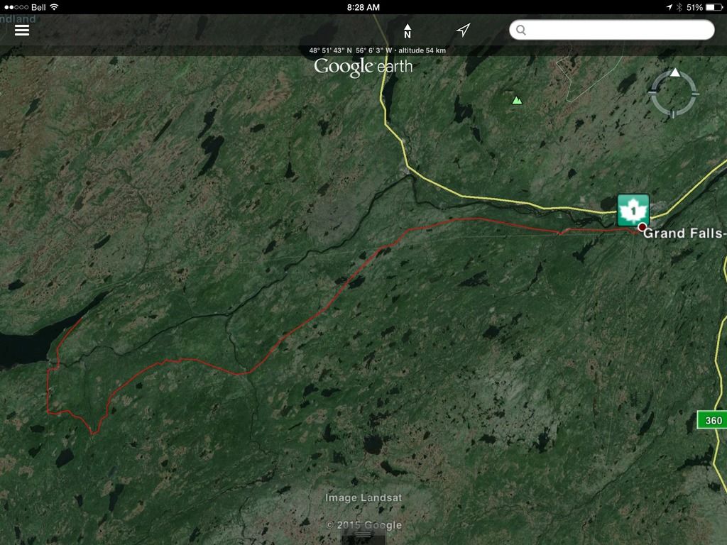
Trip Meter - 392 kms
Left Corner Brook around 11 AM this morning heading for Central. At the last minute, I thought about the Route from Millertown to Grand Falls via the old Abitibi Road. I hadn't done this route before so half adorned in riding gear, I sat at the desk and opened up Google Earth, plotted the route, and loaded into my trusty Garmin GPSMap60csx. The route as plotted is approximately 100 kms from Millertown to Grand Falls.
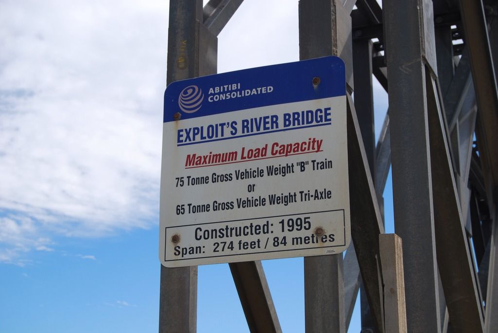
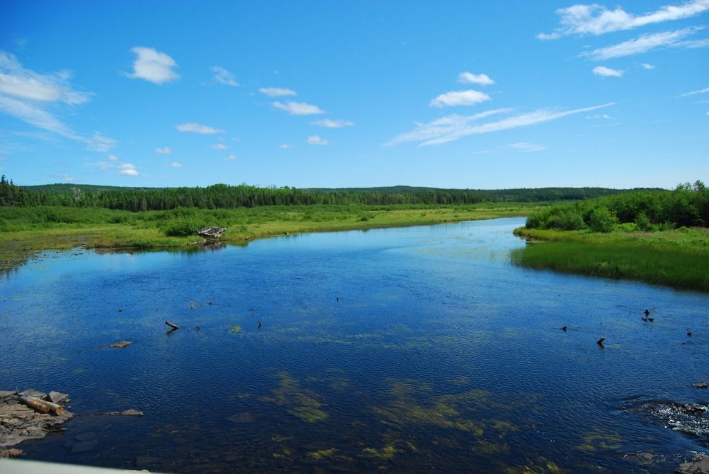
The first photo stop of the route is the bridge over the Exploits River
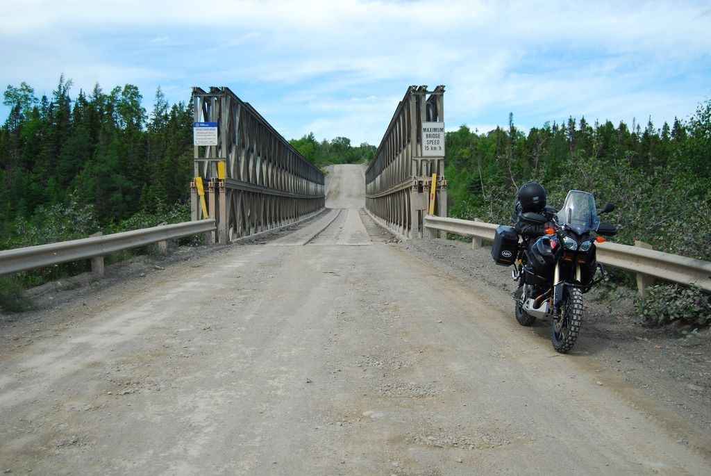
Exploits River Bridge
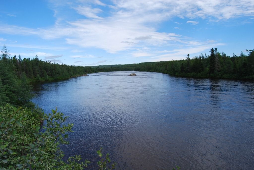
View downstream from Exploits Bridge
A few kms down the road you can hang a right towards the dam on the outlet of Red Indian Lake. Formally Abitibi Consolidated, I believe NALCOR is now the operator of the facility. The water must be low this year as the rubber portion of the dam is not in operation.
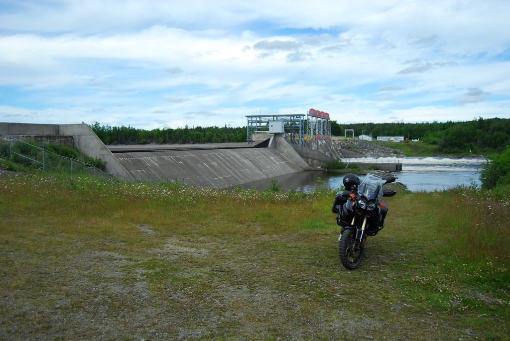

Low water levels on Red Indian Lake
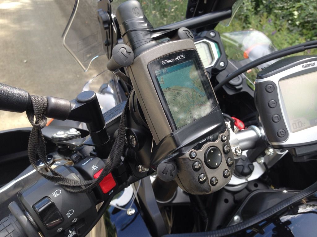
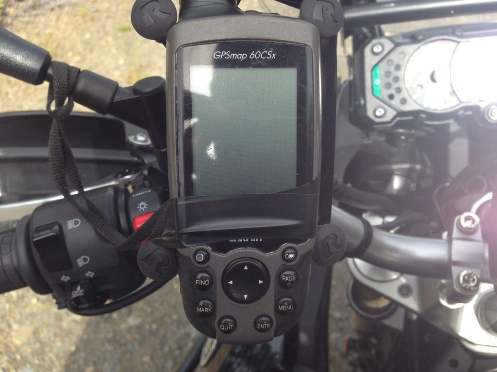
Not having been past the dam site before, I hauled out my GPS and put it in the cradle I bought at Mercers Marine in Clarenville during the SleepyHead trip last month. After just a hundred meters it was clear the RAM X-Grip wasn't up to the task for the oblong shaped Garmin. Electrical tape to the rescue! It should be noted that I bought the mount for my iPhone, of which it does an excellent job!
The next bridge crossing on the route is Harpoon Brook. Just before the turnoff that will bring you from the main road to the branch road heading towards Duck Pond Mine and Harpoon Brook, I see a grader parked at the edge of the road. Never a good thing when on two wheels! Sure enough, the several kms of road from the main road to Duck Pond was freshly graded earlier this week/day. Surprisingly there was only one pucker moment in the loose stuff.
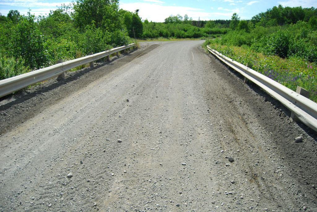
Freshly graded roadway
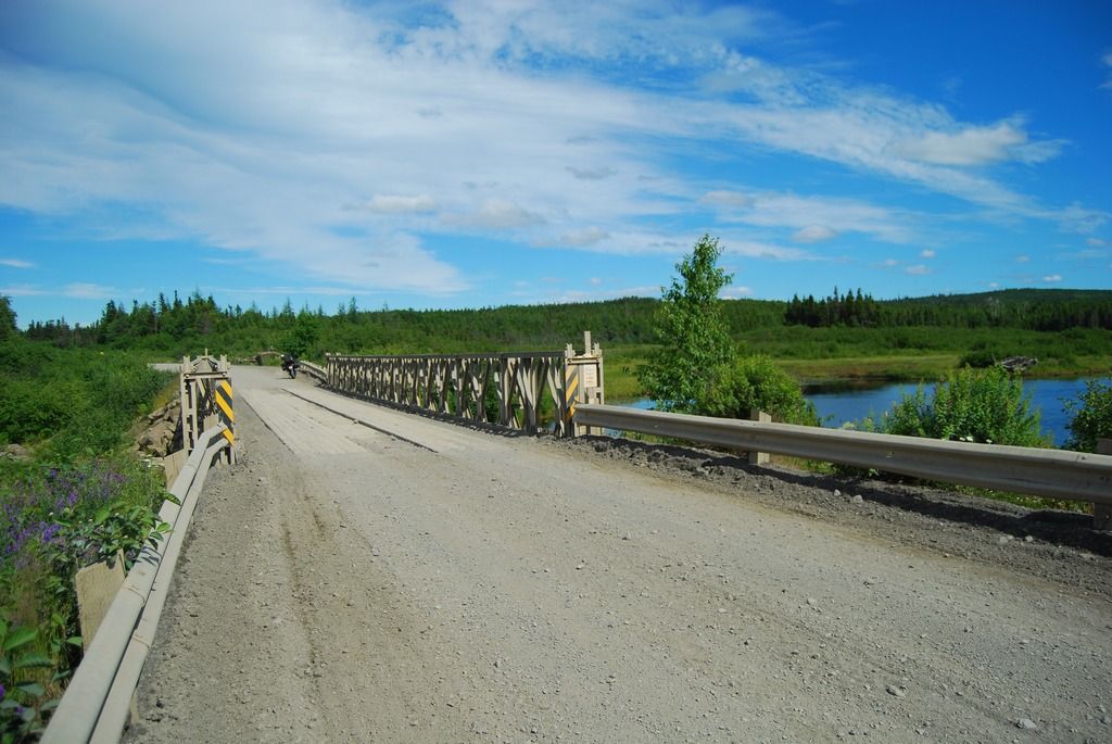
Harpoon Brook Bridge
[
South view of Harpoon Brook
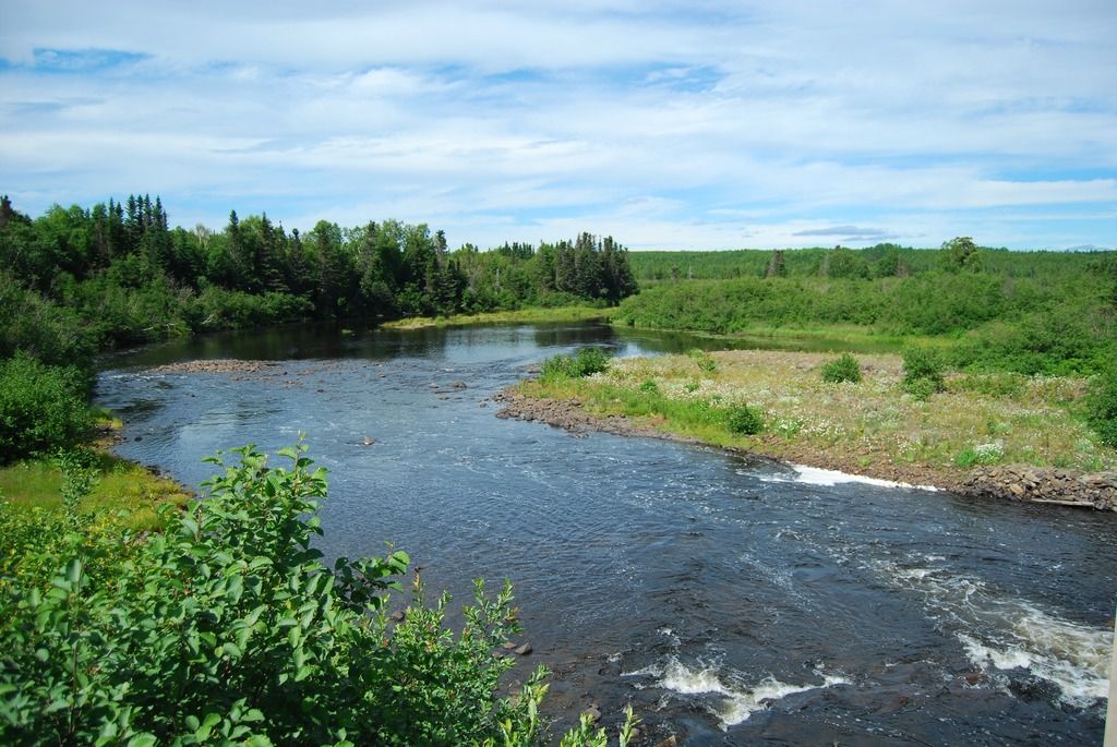
North view of Harpoon Brook
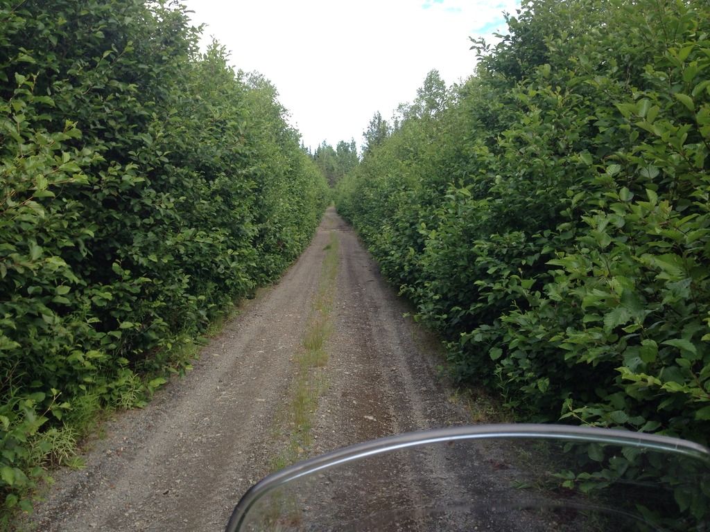
Just after Harpoon Brook, the route takes a left hand turn and begins heading north on a smaller network of Forest access roads. It becomes clear very quickly that this route haven't been maintained in years. Locals must have been moose hunting in the area last fall while the roads were wet, as large/deep vehicle tire ruts have dried into the roadway. Another fun thing to get your wheels into unexpectantly. The roads also become quite grown in with alders in places, with the alders hitting both panniers for several stretches. Large puddles, some axle height, must also be traversed. Of the dozen or so puddles I rode through, only two or three were near axle height. Not bad at all.
I continued on for what felt like 10-15 kms through a maze of alders, puddles and ruts. Eventually I came to a major intersection in which I figured I should check the GPS for directions:
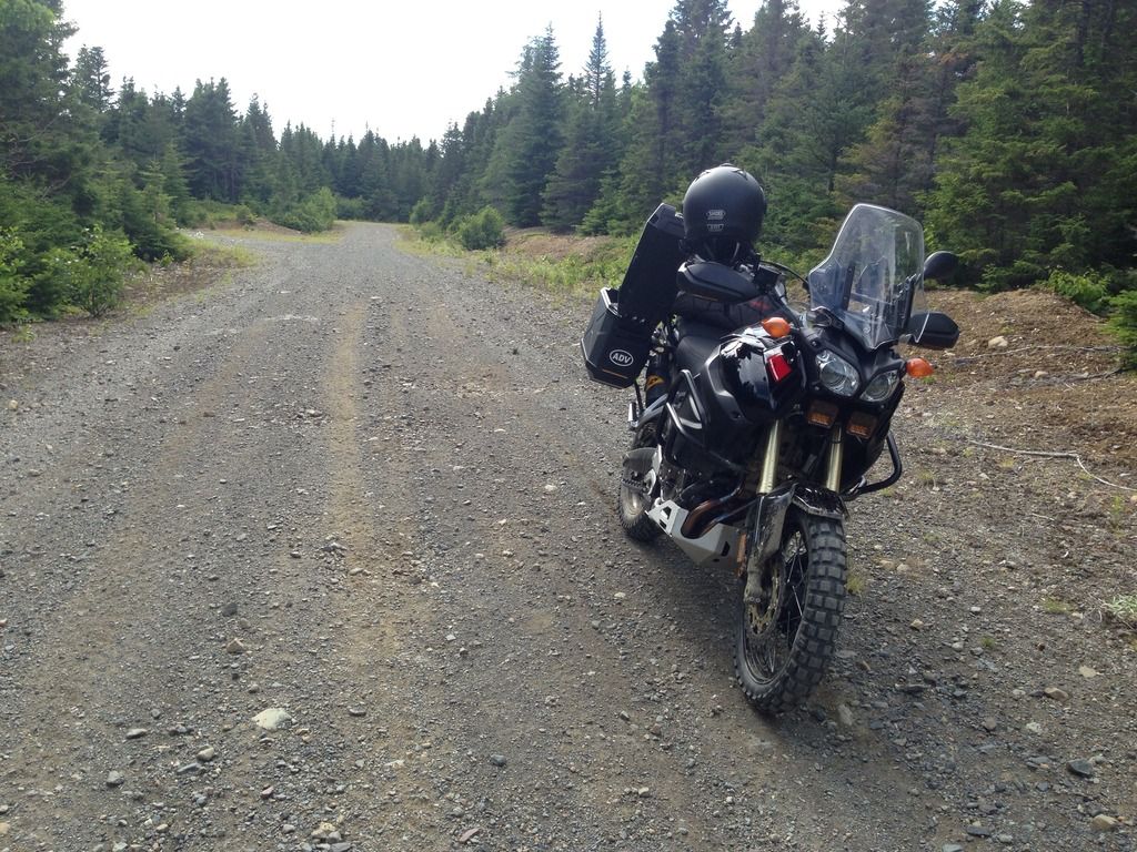
If I could offer some advice, it would be to always have a Plan B in place in the event Plan A should fail - or at minimum a spare pair of batteries or a 12 volt charger!
Lucky enough, I saved the route I plotted in Google Earth earlier this morning and e mailed it to my cell just in case. A bit of a pain stopping to haul out my cell, but certainly better than trial and error with the many branch roads within the area.
I knew the next major crossing would be Noel Paul Bridge. According to my google map, that was still another 10-15 kms away. I continued on for another 10 mins or so, the road getting smaller and technical for awhile, then opening up to a stretch that offered a more brisk pace, then small again - so on and so forth. During one of the slower, grown in section I saw a black mass running up the road ahead of me and then disappear in the alders to the left. A black bear! Looks like last years cub. Wonder where the siblings and mother are?
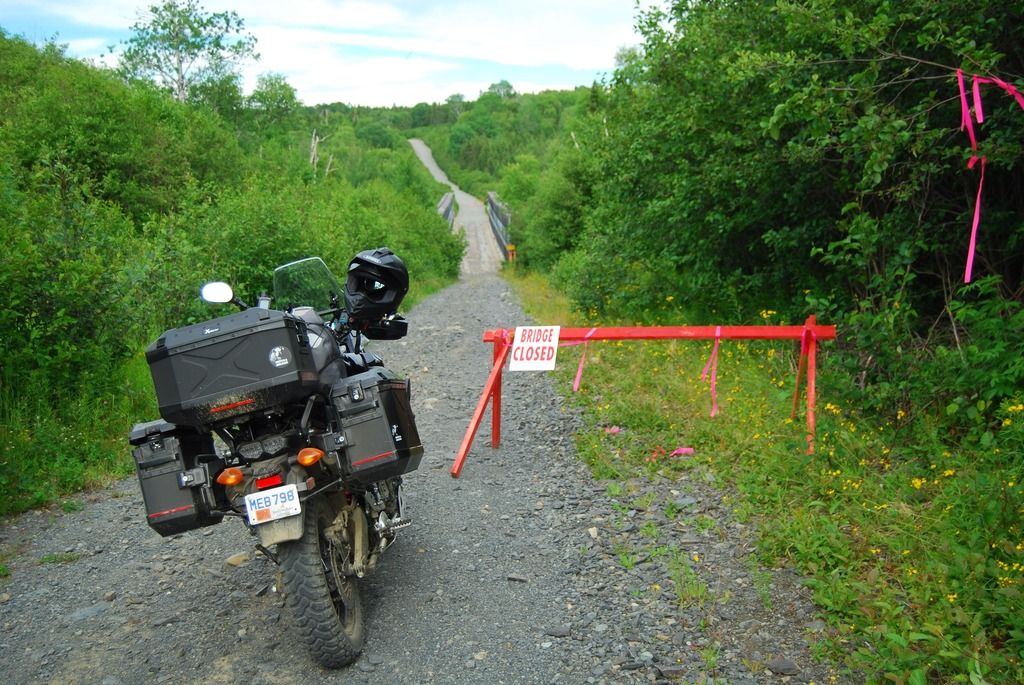
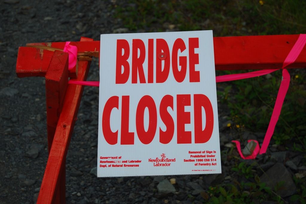
Approximately 10 mins later I reach Noël Paul Brook and was greeted by:
Trip Meter - 392 kms
Left Corner Brook around 11 AM this morning heading for Central. At the last minute, I thought about the Route from Millertown to Grand Falls via the old Abitibi Road. I hadn't done this route before so half adorned in riding gear, I sat at the desk and opened up Google Earth, plotted the route, and loaded into my trusty Garmin GPSMap60csx. The route as plotted is approximately 100 kms from Millertown to Grand Falls.

The first photo stop of the route is the bridge over the Exploits River

Exploits River Bridge


View downstream from Exploits Bridge
A few kms down the road you can hang a right towards the dam on the outlet of Red Indian Lake. Formally Abitibi Consolidated, I believe NALCOR is now the operator of the facility. The water must be low this year as the rubber portion of the dam is not in operation.


Low water levels on Red Indian Lake
Not having been past the dam site before, I hauled out my GPS and put it in the cradle I bought at Mercers Marine in Clarenville during the SleepyHead trip last month. After just a hundred meters it was clear the RAM X-Grip wasn't up to the task for the oblong shaped Garmin. Electrical tape to the rescue! It should be noted that I bought the mount for my iPhone, of which it does an excellent job!

The next bridge crossing on the route is Harpoon Brook. Just before the turnoff that will bring you from the main road to the branch road heading towards Duck Pond Mine and Harpoon Brook, I see a grader parked at the edge of the road. Never a good thing when on two wheels! Sure enough, the several kms of road from the main road to Duck Pond was freshly graded earlier this week/day. Surprisingly there was only one pucker moment in the loose stuff.

Freshly graded roadway

Harpoon Brook Bridge
[

South view of Harpoon Brook

North view of Harpoon Brook
Just after Harpoon Brook, the route takes a left hand turn and begins heading north on a smaller network of Forest access roads. It becomes clear very quickly that this route haven't been maintained in years. Locals must have been moose hunting in the area last fall while the roads were wet, as large/deep vehicle tire ruts have dried into the roadway. Another fun thing to get your wheels into unexpectantly. The roads also become quite grown in with alders in places, with the alders hitting both panniers for several stretches. Large puddles, some axle height, must also be traversed. Of the dozen or so puddles I rode through, only two or three were near axle height. Not bad at all.

I continued on for what felt like 10-15 kms through a maze of alders, puddles and ruts. Eventually I came to a major intersection in which I figured I should check the GPS for directions:


If I could offer some advice, it would be to always have a Plan B in place in the event Plan A should fail - or at minimum a spare pair of batteries or a 12 volt charger!
Lucky enough, I saved the route I plotted in Google Earth earlier this morning and e mailed it to my cell just in case. A bit of a pain stopping to haul out my cell, but certainly better than trial and error with the many branch roads within the area.
I knew the next major crossing would be Noel Paul Bridge. According to my google map, that was still another 10-15 kms away. I continued on for another 10 mins or so, the road getting smaller and technical for awhile, then opening up to a stretch that offered a more brisk pace, then small again - so on and so forth. During one of the slower, grown in section I saw a black mass running up the road ahead of me and then disappear in the alders to the left. A black bear! Looks like last years cub. Wonder where the siblings and mother are?
Approximately 10 mins later I reach Noël Paul Brook and was greeted by:


Last edited: